
Austin’s neighborhoods conjure up too many stereotypes to count. You’ve got hipster areas, preppy places, neighborhoods where college kids thrive, and of course, ghettos.
It seems as if there’s a neighborhood for everyone in Austin.
And while the city consistently ranks as one of the best places to live in Texas thanks in part to tons of entertainment and jobs, it’s not all rainbows and sunshine in Austin. Some neighborhoods aren’t as safe as others.
So the question arises, which Austin neighborhoods are the most dangerous and which are the safest?
Today, we’ll use Saturday Night Science to determine which Austin hoods need a little tender loving care. We examined 60 of Austin’s neighborhoods to find out the most dangerous places to live.
Not sold on Texas? Take the two-minute Find Your Place quiz and see which state actually fits you.
$60,159 median income
 Located in
Williamson County, Texas
Located in
Williamson County, Texas
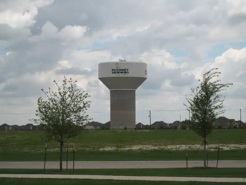
McKinney is a city in and the county seat of Collin County, Texas, and the second in population to Plano. It is part of the Dallas-Fort Worth metroplex, and is located about 32 miles north of Dallas.
Data | Crime | Cost of living | Movers | Compare
$38,101 median income
Martin Luther King-Hwy 183 has a pretty straightforward name. It’s located around the intersection of Highway 183 and Martin Luther King Jr. Blvd. in the eastern section of Austin. A weak economy and a high cost of living make this one of the toughest areas of the city to live.
It can be difficult for the area’s 8,366 residents to find a job. The unemployment rate sits at 7.5%. Even the available gigs can make it difficult to pay the bills. The median income equals $38,101, compared to a median home price of $167,560.
The area does offer plenty of amenities, including multiple churches and lots of restaurants.
$38,935 median income
Saint John’s gets its name from an orphanage founded by African-American leaders in the early part of the 20th century. Sadly, the institution burned down in the 1940s. These days, the area is centered around a stretch of I-35 in the northern section of the city. It also represents one of the least attractive parts of Austin.
A sluggish economy accounts for most of the problems. The 9,414 locals have trouble stretching their $38,935 in median income. At the same time, the unemployment rate runs 6.5%.
Saint John’s has its share of amenities, though. It includes a significant amount of shopping. There are also educational opportunities, such as the CyberTex Institute of Technology.
$37,831 median income
$43,405 median income
$62,574 median income
North Burnet follows a curve in Highway 1, near the intersection of Highway 183, part of the northern area of Austin. Theoretically, a short hop on the one of the highways makes for a convenient commute. However, traffic often slows travel on the major roads and public transportation is limited.
Otherwise, North Burnet has a lot going for it. The economy is fairly strong, with a median income of $62,574 and an unemployment rate of 2.6%. Even with this financial security, the neighborhood remains affordable. The median home value sits at $271,400.
In terms of amenities, North Burnet offers a lot. You can head down to the main shopping center, or check out the University of Texas at Austin’s J.J. Pickle Research Campus.
$60,827 median income
For more than 100 years, Montopolis stood as an independent community. Originally founded in the 1830s, it wasn’t fully enveloped by Austin until the 1970s. These days, it counts as the number 7 worst place to live in the city.
Jobs represent the most pressing challenge for the area’s 10,471 residents. The median income comes in at $60,827 and the unemployment rate sits at 6.7%.
Located in the southeast part of the city, Montopolis has its charms. It provides excellent affordable and good access to amenities. In addition, residents can enjoy Roy G. Guerrero Colorado River Metro Park.
$57,824 median income
Traditionally, Highland has a reputation as a commercial center. Home of the Highland Mall and other retail spots, this spot in the northern part of Austin once drew shoppers from throughout the city. That is, until the mall closed in 2015, leaving a big empty spot in the middle of the neighborhood. It’s no surprise, then, that Highland represents the number 8 least inviting part of the city.
Even without the mall, the area’s economy has kept humming. The unemployment rate comes in at 4.5% and the median income hovers at $57,824. Still, affordability is a problem. High real estate prices lead to a median home price of $327,250, a stretch for many in the neighborhood.
$48,241 median income
Georgian Acres sits in the north-central part of the city. A sluggish economy and some concerns about crime make this the number 9 least enticing neighborhood in Austin.
Finding a job isn’t that hard in the area. The unemployment rate sits at 5.2%. However, these tend to be low-paying gigs, as the neighborhood’s median income comes in at just $48,241.
Bordered by I-35 and Highway 183, Georgian Acres offers excellent access to the rest of the city. The area itself is mostly residential, though it features some shopping and commercial areas as well.
$50,880 median income
The receipts
Compare the top ten
Pick a metric. The bars rescale. The red line is Texas’s statewide median.
Texas statewide median: $300,957
Texas statewide median: $78,476
Saturday Night Science
Methodology: How we determined the most dangerous Austin neighborhoods in 2026
To figure out how bad a place is to live in, we only needed to know what kinds of things people like and then decide what places have the least amount of those things. We plugged the following criteria into Saturday Night Science to get the worst neighborhoods in Austin:
- High crime (Estimated)
- High unemployment (Less jobs)
- Low median income (Less pay)
- Low population density (No things to do)
- Low home values (No one’s willing to pay to live here)
Then, we ranked each neighborhood in Austin, Texas for each of these criteria from worst to best.
Next, we averaged the individual rankings for each criterion into a “Worst Score.”
The neighborhood with the lowest “Worst Score” ranks as the most dangerous neighborhood of Austin.
The article is an opinion based on facts and is meant as infotainment. We updated this article for 2026. Skip to the end to see the list of all 60 neighborhoods ranked from worst to best.
The full plate
Most dangerous neighborhoods to live in Austin for 2026
Click any column to sort. Search by neighborhood name.
| Rank | Neighborhood | Population | Home Value | Median Income |
|---|---|---|---|---|
| 1 | McKinney | 5,030 | $232,600 | $60,159 |
| 2 | Martin Luther King-Hwy 183 | 8,366 | $167,560 | $38,101 |
| 3 | Saint Johns | 9,414 | $119,120 | $38,935 |
| 4 | Saint Edwards | 5,395 | $96,800 | $37,831 |
| 5 | Heritage Hills | 7,129 | $191,400 | $43,405 |
| 6 | North Burnett | 10,086 | $271,400 | $62,574 |
| 7 | Montopolis | 10,471 | $258,675 | $60,827 |
| 8 | Highland | 5,307 | $327,250 | $57,824 |
| 9 | Georgian Acres | 9,299 | $190,667 | $48,241 |
| 10 | Franklin Park | 14,919 | $155,325 | $50,880 |
| 11 | Parker Lane | 9,056 | $290,467 | $46,454 |
| 12 | West Congress | 3,611 | $314,775 | $64,496 |
| 13 | Hancock | 5,466 | $520,060 | $55,204 |
| 14 | North Shoal Creek | 4,622 | $464,800 | $64,072 |
| 15 | North Austin | 27,374 | $246,400 | $52,321 |
| 16 | Coronado Hills | 3,025 | $269,500 | $38,137 |
| 16 | Mlk | 5,261 | $367,917 | $68,127 |
| 18 | West University | 15,840 | $365,150 | $19,798 |
| 19 | Johnston Terrace | 1,314 | $312,000 | $74,318 |
| 20 | Southeast | 5,009 | $314,200 | $85,947 |
| 21 | North Loop | 5,265 | $451,583 | $64,884 |
| 22 | North Lamar | 7,350 | $197,433 | $50,636 |
| 23 | Upper Boggy Creek | 5,219 | $431,900 | $71,323 |
| 24 | Wooten | 7,151 | $388,767 | $60,739 |
| 25 | Sweet Briar | 6,433 | $279,875 | $65,239 |
| 26 | West Gate | 3,908 | $437,600 | $55,423 |
| 27 | Govalle | 5,507 | $408,300 | $81,886 |
| 28 | East Congress | 3,591 | $299,500 | $64,305 |
| 29 | Pleasant Valley | 14,842 | $284,500 | $49,743 |
| 30 | University Hills | 4,803 | $369,067 | $73,726 |
| 31 | North University | 4,338 | $365,567 | $40,013 |
| 31 | Rosewood | 5,859 | $425,467 | $59,946 |
| 33 | Windsor Park | 16,512 | $369,622 | $77,716 |
| 34 | Barton Hills | 9,368 | $554,125 | $89,750 |
| 34 | University Of Texas | 9,719 | $409,333 | $64,666 |
| 37 | Windsor Hills | 9,032 | $259,667 | $60,570 |
| 37 | Central East Austin | 5,879 | $486,025 | $74,348 |
| 37 | Riverside | 12,314 | $377,650 | $64,246 |
| 39 | Dawson | 3,176 | $422,867 | $73,843 |
| 40 | South Manchaca | 7,520 | $356,212 | $80,330 |
| 41 | Bouldin | 6,229 | $659,500 | $84,789 |
| 42 | Allandale | 10,127 | $523,550 | $82,050 |
| 43 | Triangle State | 1,820 | $453,800 | $71,206 |
| 44 | Galindo | 5,346 | $427,800 | $78,638 |
| 45 | Garrison Park | 11,315 | $310,044 | $78,928 |
| 46 | Pecan Springs Springdale | 7,352 | $341,500 | $82,804 |
| 47 | Hyde Park | 5,833 | $563,817 | $54,202 |
| 48 | Rmma | 6,070 | $501,260 | $104,286 |
| 49 | East Cesar Chavez | 3,639 | $484,600 | $75,122 |
| 50 | Old West Austin | 3,955 | $1,070,100 | $82,566 |
| 51 | South Lamar | 8,635 | $470,471 | $69,392 |
| 52 | Windsor Road | 5,510 | $918,567 | $123,681 |
| 53 | Brentwood | 10,234 | $457,414 | $74,838 |
| 54 | Holly | 2,934 | $484,720 | $74,274 |
| 55 | South River City | 6,483 | $651,617 | $93,876 |
| 56 | Chestnut | 2,390 | $434,700 | $79,676 |
| 57 | Rosedale | 6,179 | $619,317 | $126,210 |
| 58 | Zilker | 9,287 | $681,512 | $118,667 |
| 59 | Crestview | 6,739 | $484,400 | $125,606 |
| 60 | Downtown | 12,436 | $764,975 | $106,972 |
Source: U.S. Census ACS 2020-2024. All 60 Austin neighborhoods.
Summary
Summary: The worst neighborhoods around Austin
Well, there you have it — the worst of the neighborhoods in Austin with McKinney landing at the bottom of the pack.
The worst neighborhoods in Austin are McKinney, Martin Luther King-Hwy 183, Saint Johns, Saint Edwards, Heritage Hills, North Burnett, Montopolis, Highland, Georgian Acres, and Franklin Park.
As mentioned earlier, the neighborhoods in Austin aren’t all bad. Downtown takes the cake as the best place to live in Austin.
We ranked the neighborhoods from worst to best in the chart below. Wondering how McKinney stacks up against a bigger name? See McKinney, TX vs. Plano, TX side by side.
Questions and answers
Worst Neighborhoods In Austin FAQs
What is the most dangerous neighborhood in Austin?
McKinney ranks as the worst neighborhood in Austin for 2026, according to Saturday Night Science. Martin Luther King-Hwy 183 and Saint Johns are next on the list.
What are the worst neighborhoods in Austin?
The worst-ranked neighborhoods in Austin are McKinney, Martin Luther King-Hwy 183, Saint Johns, Saint Edwards, Heritage Hills, North Burnett, Montopolis, Highland, Georgian Acres, and Franklin Park. We scored all 60 neighborhoods in the city.
Why does McKinney rank as the worst?
McKinney posts the roughest combined numbers in Austin: a median household income of $60,159 and a median home value of $232,600, with crime, unemployment, and density folded into the score.
Are these neighborhoods dangerous everywhere?
No. The scores are neighborhood-wide averages, and conditions change block by block and hour by hour. Plenty of people live in these neighborhoods without incident; the numbers just say the odds run tougher.
How do you rank the worst neighborhoods?
Each neighborhood is scored on crime, unemployment, income, density, and home values, using Census tract and FBI data. The worst combined score tops the list.